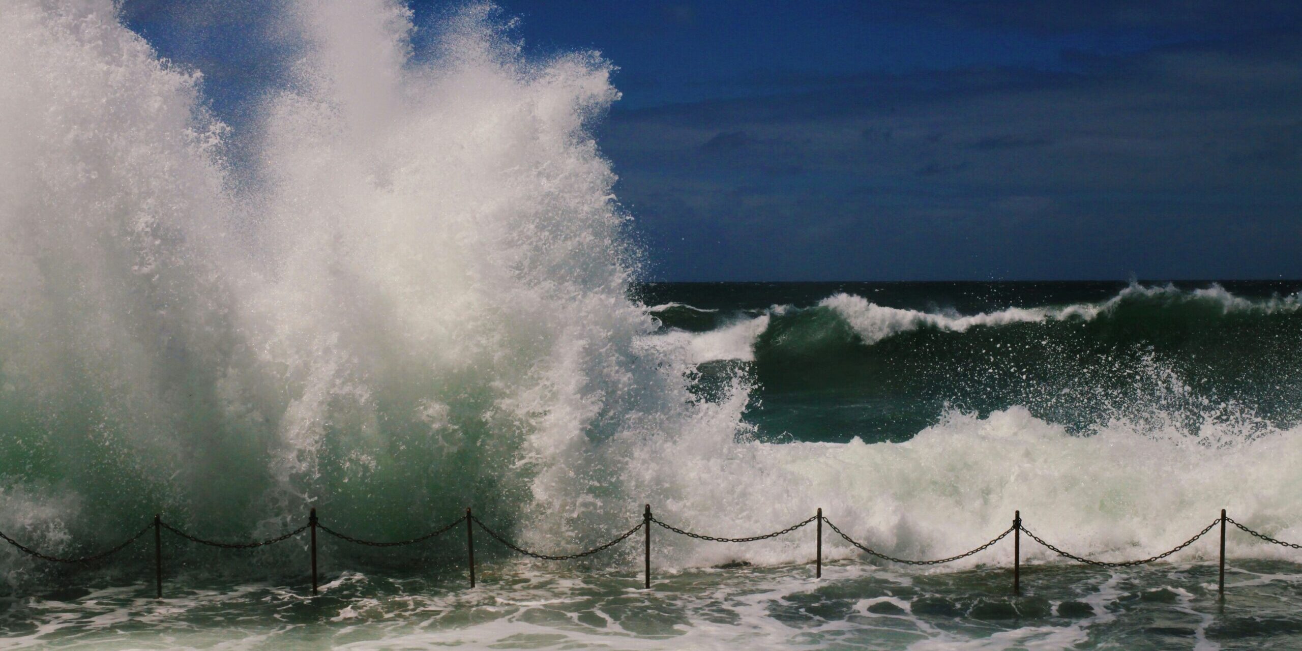
We could be underestimating the global population who’ll be affected by sea level rise by almost 70%, a new Dutch study finds.
Researchers found that hundreds of past studies on coastal hazards – like tsunami, storm surges, and sea level rise – used models that often underestimate current sea levels.
The Pacific and Southeast Asia are the regions most affected by this problem, with sea levels currently over a metre higher, on average, than these models show.
The Science Media Centre has gathered comments from five NZ and Pacific experts.
Professor Tim Naish, Antarctic Research Centre, Te Herenga Waka, Victoria University of Wellington, comments:
“This article suggests many local coastal hazard impact assessments around the world have underestimated future local sea-level rise, and the related risks, by not taking into account local factors such as land subsidence (sinking) and relying on inaccurate land elevation data.
“Fortunately, Aotearoa New Zealand is not one of those countries. For the majority of our coastline where people live, Land Information New Zealand have generated highly accurate land elevation data by using lasers from aircraft to measure distances, and they are connecting this land elevation data with coastal bathymetry measurements registered to nationally and globally consistent geodetic datums. This will be used widely in coastal hazard risk assessment.
“The NZSeaRise and Our Changing Coast programmes funded by MBIE Endeavour Fund over the last ten years provide location-specific projections of sea-level change to the year 2150 for the climate scenarios outlined in the IPCC’s 6th Assessment Report. These sea-level rise estimates are currently available at 2km spacing along the coastline, but a new version with 200m resolution is about to be released.
“The sea-level projections allow users to estimate relative sea-level rises which account for global (e.g. melting land ice) and regional (e.g. corresponding large scale adjustments in Earth’s surface) changes as well as local changes from local vertical land movements. These vertical land movements are measured from satellite-borne radar systems and permanent GPS receivers across the country, yielding movement rates with the accuracy of +/-1 mm/year.
“In between earthquakes, 70% of the coastline of Aotearoa New Zealand is subsiding due to ongoing tectonic processes, fluid extraction and ground compaction. This land subsidence can be as high as the rate of global sea-level rise itself (+4 mm/year), significantly increasing the risk of, and reducing the time before, critical thresholds are breached.
“An online tool for the public and decision makers is also referred to in the Ministry for the Environment’s Coastal Hazard and Climate Change Guidance. Councils and infrastructure providers around the motu are now using these estimates that include VLM for their planning work and risk assessments, thereby ensuring adaptation solutions can be found for those at risk communities and assets.”
Conflict of interest statement: “I am the Co-Principal Investigator of the NZSeaRise and Our Changing Coast programmes, as well as the Chair of the World Climate Research Programme (WCRP) which helps co-ordinate the science for IPCC sea-level projections.”
Gabriel Mara, Pacific Adaptation and Loss and Damage Analyst, Climate Analytics, comments:
“This paper finds something quite concerning; many of the projections have underestimated both what we are currently measuring and what we are likely to experience in the future. For Small Island Developing States (SIDS), that is far from a discrepancy. Because if the projections are conservative, then the policies, infrastructure standards and adaptation plans built on those projections are conservative also. And in our (SIDS) context, conservative does not mean safe. It means SIDS are further behind then currently believed.
“This is serious for Pacific SIDS: as parts of the western tropical and southwest Pacific have historically experienced rates of sea-level rise above the global average due to ocean dynamics. Sea level is not uniform, it shifts with currents, heat and gravity. So while globally the numbers can look one way, locally the lived experience is very different.
“The paper notes (in fig. 4) that compared to other regions, the Pacific shows lower exposure in aggregate terms. But we have to interrogate what “lower exposure” means. If exposure is measured by total population or absolute land area, then yes, small islands will appear smaller in the dataset. But proportionally? Existentially? Losing 1% of land in a large continental country is not the same as losing 1% of a small island state. In our context, that 1% could be an entire village or half a town, a burial ground, a freshwater lens and livelihood for subsistence survival.
“And this is where the implications move past adaptation planning. If projections and threshold triggers are too low, adaptation becomes reactive rather than anticipatory. You build a seawall for yesterday’s sea level. This brings soft and hard limits much earlier, compressing the window between ‘adaptable’ and ‘unavoidable loss’. This leaves residual risk higher than planners assume as countries will face greater losses than projected because hazard baselines are underestimated.
“Even with the levels and projections that are considered standard references, Pacific communities are already facing the impacts of sea-level rise. Right now, coastal erosion and saltwater intrusion is actively occurring in the Pacific. Sacred sites are already being relocated. People are already forced to leave their ancestral lands.
“If sea-level rise is happening faster than what is currently thought, then losses including non-economic losses are also happening faster than our planning and anticipatory frameworks assume or are equipped for. Non-economic loss and damage is rising quietly alongside the water, unavoidable losses will accumulate sooner and at greater scale. That directly affects discussions around Loss and Damage finance, responsibility and equity.
“While the study does not directly assess whether the underestimated projections feed into IPCC assessments, it does highlight something important. Many national policies rely heavily on frequently referenced sources like the IPCC as the global scientific benchmark. If the studies it uses are conservative and synthesise the same into reports, the true description of what the reality is has been severely limited as the panel operates on assessment cycles.
“For SIDS, that suggests we need to read the science carefully, especially like that of the Small Islands chapter, and ask whether we are planning for the median, or for the reality experienced on the ground.
“Can SIDS and coastal states only plan for the median of current models, or can they be aided to prepare for what is increasingly observable in front of them?”
Conflict of interest statement: “Gabriel has previously served as Climate Change Officer for the Fiji Government, supporting national adaptation policy, the NAP process, the development of Fiji’s SOP for Planned Relocation and the operationalisation of the Climate Relocation of Communities Trust Fund. Internationally, he has represented Fiji as an Adaptation Negotiator under the UNFCCC and later served as G77 and China Coordinator for NAPs.”
Dr Emma Ryan, Senior Lecturer in Environmental Science at the University of Auckland, comments:
“This study is a welcome addition to global sea‑level rise research. Many worldwide assessments rely on coarse resolution global satellite data. By using a more accurate and globally-consistent way of measuring coastal land elevation, the authors show that earlier global studies may have underestimated how many places are exposed to future sea‑level rise. This is an important improvement in our global understanding.
“However, global studies can only take us so far. They are not designed for local planning or decision‑making. While they can highlight global and regional differences, the impacts of sea level rise on coasts vary a lot from place to place, depending on factors like land sinking or rising (vertical land motion, often caused by tectonic factors), sediment movement, storm patterns, waves, and long‑term shoreline change patterns.
“For Aotearoa New Zealand and Pacific Island nations, high‑quality local data remains essential. New Zealand and Pacific Island nations need more investment in obtaining and maintaining accurate elevation datasets for both the coastal zone and the nearshore. New Zealand is already investing in high-quality local data. The New Zealand Coastal Change Database (coastalchange.nz) provides long‑term, nationally consistent coastal erosion rates that can be used to underpin local or regional coastal hazard and risk assessments.
“Other national research programmes are updating localised sea‑level rise projections with vertical land movement data, which will give communities more accurate information for regional and local planning. New Zealand and Pacific Island nations should prioritise local data for decision making about sea-level impacts.”
Conflict of interest statement: “No conflicts of interest. I currently have research projects funded by the New Zealand government (e.g. Natural Hazards Resilience Platform, MBIE) and Department of Conservation, and the Coastal People: Southern Skies centre for research excellence. I am a researcher on the project linked to coastalchange.nz.”
Dr Dalila Gharbaoui, Political and Social scientist, Adjunct Research Fellow, University of Canterbury, comments:
“This study offers an important correction to how we understand coastal risk. By showing that more than 99% of global coastal hazard assessments have misinterpreted the relationship between sea‑level height and land elevation, the authors highlight a major methodological issue in how exposure is calculated. It indicates that a significant number of global and regional coastal hazard assessments may be underestimating current exposure, particularly in the Indo‑Pacific.
“For Pacific Island nations and for vulnerable coastal regions, these findings suggest that some current hazard maps and planning tools may be underestimating present‑day risk. Many communities already experiencing more frequent inundation, shoreline loss, or saltwater intrusion may be living with conditions more severe than what official assessments show. For governments across the region, this means some planning frameworks, coastal hazard maps, and investment decisions may be based on outdated baselines. This has direct implications for land‑use planning, infrastructure design, and long‑term adaptation pathways.
“This is also a reminder that climate impact assessments are continually improving as data and modeling advance, but this study reinforces a broader issue raised in climate mobility research: many widely used assessments rely on global averages or projections that do not fully capture local realities, creating a tension between modeled definitions of “habitability” and the conditions communities are already experiencing on the ground.
“These findings reinforce the urgent need to reassess existing coastal hazard maps, infrastructure planning, and adaptation strategies. They also carry major implications for climate finance. Funding decisions must reflect the accurate level of risk communities face today, as these gaps influence how we quantify loss and damage, including cultural and non‑economic losses central to communities’ identity and wellbeing. Accurate baselines are essential for ensuring climate‑finance mechanisms like the Loss and Damage Fund direct support in proportion to the real risks faced by communities.
“This study highlights the need for locally grounded, regularly updated risk assessments to inform durable, equitable, well‑targeted adaptation policy and effective climate‑finance decisions.”
Conflict of interest statement: “N/A.”
Professor Silvia Serrao-Neumann, Environmental Planning, The University of Waikato, comments:
“My quick read of the paper indicates that it won’t affect Aotearoa as much because it focuses on the implications for the Global South, especially low-lying coastal areas in Southeast-Asia.
“Aotearoa has the Searise portal which accounts for the vertical land movement cited in the paper as one of the critical errors. In summary, we don’t lack the information on the impacts of sea level rise on our coasts. Our impediment is more of a political nature, as in being more proactive in decisions to avoid further developing coastal areas at-risk of sea level rise and related coastal hazards such as erosion and inundation.”
Conflict of interest statement: “I don’t have any conflict of interest to declare.”