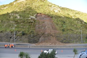
Yesterday’s landslip that blocked State Highway 1 into Wellington has been cleared away, but how did it happen and are we likely to see more of these types of slips?
The Science Media Centre put the following questions about the slip to engineering geologist, Dr Chris Massey.
Dr Chris Massey, engineering geologist, GNS Science, comments:
What type of slip was this and what likely caused it?
“We would call this type of landslide a debris avalanche, and it occurred on what appears to be a modified slope, i.e. where the slope had been formed for construction of the road. It is a debris avalanche because the source material (i.e. the material in which it originated) appears to comprise a combination of soil and rock “debris”, in this case predominantly rock, which appears to be Greywacke sandstone.
“The video footage of the landslide in the media shows that the material may have originally moved as a sliding block, which then broke down into smaller boulders and cobbles with increasing movement, the video footage then shows the mass breaking down with some of the boulders rolling, bouncing and flowing down the slope as an avalanche, until coming to rest on the highway.
“Such landslides do not always need a trigger to cause them as they can occur as a result of accumulated smaller movements over time, which can lead to changes in the strength of the rock mass, which can ultimately lead to failure. It might be that in this case the recent earthquakes in the region could have prepared (weakened) the slope for failure.
“However, it’s also possible that such changes to the rock mass forming the slope may have occurred over the decades since the slope was cut (formed) for the construction of the highway in about the 1950s. Many people like to link a landslide event to a causative factor such as an earthquake or rain event, and for many landslides this is usually the case.
“However, landslides can occur when there is no obvious cause. A recent example of such a failure is the Young River landslide (near Makarora on the South Island), where about 10M m3 of debris failed during a period of sunny weather in October 2007. No obvious trigger could be attributed to its occurrence.”
Are these types of slips common and do we increasingly have a problem with unstable rock near major roadways around New Zealand?
“Small volume debris avalanches (similar to yesterday’s) are common along roads and coastal slopes, especially in Wellington. GNS Science has compiled a data base of such failures that have occurred in the region over the past 43 years. This database contains more than 7,600 landslides.
“Many of these landslides are from steep modified (cut) slopes, adjacent to roads. This is because for slopes adjacent to roads, the slopes have been cut to enable construction of the road. Cutting entails steepening the slope. When you steepen a slope you can make it more unstable as you are changing the forces operating within the slope.
“Over time (multiple decades), the slope materials (in both natural and modified slopes) can weather and small localised movements can occur, which can make the slope more susceptible to failure, we call this “slope ripening”. Given than many of the modified slopes in and around Wellington were formed in the 1950’s as part of the urbanisation of Wellington, it is possible that some such slopes might be “ripe” for failure.
“In many cases such landslides in the region have been small in volume i.e. typically less than 10 m3, although larger ones have occurred, but more infrequently. The landslide that occurred yesterday has been estimated to be in the order of a few hundreds of m3.
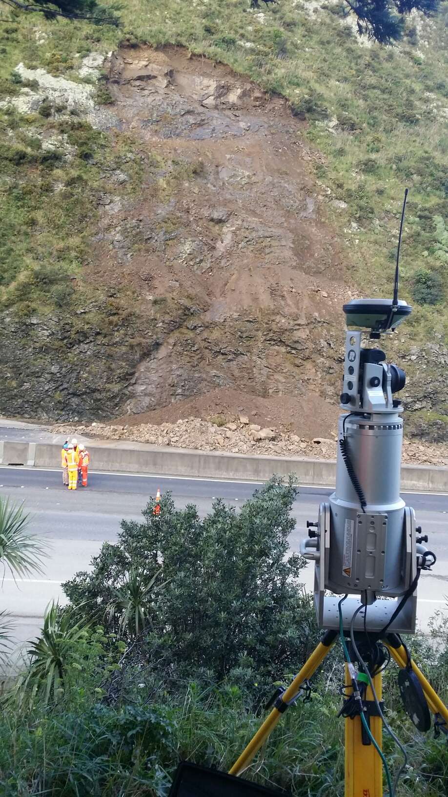
“A team from GNS Science went out to survey the slope yesterday using a Terrestrial Laser Scanner, which is a ground based LIDAR instrument, which we use to make a detailed map of the ground. We will difference (subtract) this post landslide map of the surface from the pre-landslide map of the surface (which we already have from the WCC commissioned airborne LIDAR), to quantify the volume of the landslide, and its dimensions.”
How big an issue is this and what are the key ways engineers can tackle this issue?
“It’s obviously a big issue as it affected people’s ability to travel out of Wellington. However, the landslide was quite small in volume, and larger ones have and will occur in the region in the future. During a large earthquake, such as a Wellington Fault earthquake, it is possible that many similar landslides might occur, but they would occur at the same time and some could be much larger.
“A good comparison, although the slopes are bigger down there, is what happened along SH1 South and North of Kaikoura during the Kaikoura earthquake. Although Wellington slopes aren’t as big, it is likely that during a similarly strong earthquake, many modified and natural slopes in Wellington might fall down.
“Engineers typically have two approaches they use to mitigate such issues: 1) treat at source, which involves trying to stabilise where the landslide might originate using such techniques as bolting, doweling, buttressing, retaining walls, and mesh; and 2) catching the debris once it leaves the source using such techniques as buttresses, check dams, retaining walls, fences and attenuators to prevent the debris from impacting the at risk people/infrastructure.
“A third option, which is usually the best one, is to avoid the hazard, however, in many places this is not possible.”