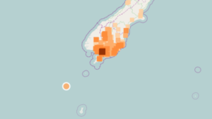
A magnitude 6.4 earthquake that struck the Auckland Islands on Tuesday evening was close to, if not on, the subduction zone where the Australian Plate dips below the Pacific Plate, according to seismologists.

The quake was centred about 200km to the southwest of Snares Island, part of the Auckland Islands group. GNS seismologist Dr Bill Fry told stuff.co.nz that it wasn’t possible to say for certain that the earthquake was on the plate boundary, “because we have no instrumentation close by”.
“We get earthquakes like this all around the Pacific. It’s where a lot of the movement of the Earth is accommodated,” Dr Fry said. It would have “insignificant to negligible” impact on the Alpine Fault, as it was essentially within the background stress happening on a regular basis.
The 7pm earthquake was initially recorded as being in the South Island, due to GeoNet’s systems being more sensitively tuned to local earthquakes.
The Puysegur Trench, which spans more than 800km south of the South Island, formed a well-established subduction system, Dr Fry told the NZ Herald.
The 2009 7.8 Fiordland earthquake struck close to the northern end of the trench, while a 7.2 quake in 2004 hit the trench itself. Dr Fry said there was much more scientists could learn about the quake zone, but its remote location made it hard to investigate.