New Zealand scientists have used GPS data to better understand how the Earth’s mantle is melting deep below the North Island’s volcanoes.
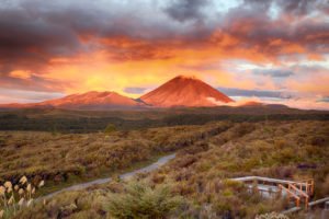 The study, published today in Nature, used GeoNet’s GPS sensors to measure horizontal and vertical shifts over the past decade, in a region stretching from Lake Taupō to the Bay of Plenty.
Writing on The Conversation, Victoria University of Wellington’s Associate Professor Simon Lamb and Professor Timothy Stern said, in general, volcanic activity happens when there is molten rock at depth but it was difficult to determine what caused the melting in the first place since the rocks were buried by thick layers of volcanic material.
Dr Lamb told Radio NZ the GPS data showed an “extraordinary pattern of parts of the central North Island are very rapidly sinking, but also at the same time contracting, so that the area of the region that’s sinking is getting slightly smaller”.
He said these areas indicated places deep in the Earth where mantle was melting, which might feed future volcanic eruptions. “But with this study, it’s very early days really, we can’t actually predict imminent eruptions. We’re basically defining regions where eruptions, in general, will be more likely in the future.”
The study was covered by local media:
Stuff.co.nz: Earth’s mantle deep beneath the North Island volcano zone is melting
NZ Herald: GPS data reveals mantle melting deep below NZ
Radio NZ: NZ scientists calculate where Earth’s mantle is melting