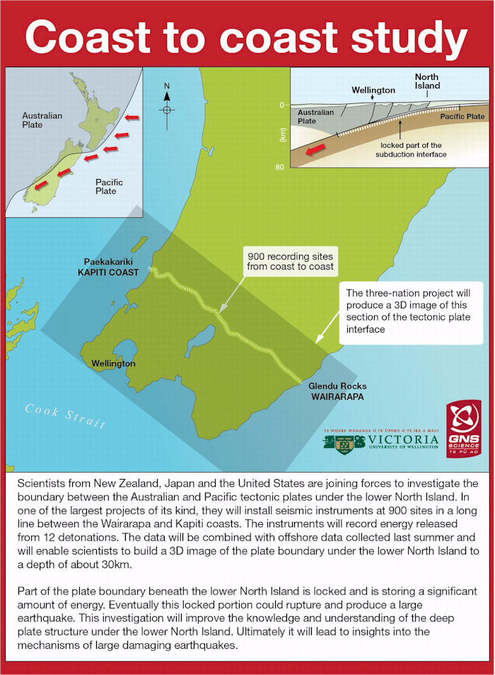
New Zealand, American and Japanese scientists are combining forces to investigate the boundary between the Pacific and Australian tectonic plates under Wellington to better understand its threat to New Zealand.
GNS Science announced the collaborative project, which will see hundreds of portable seismographs installed in a line across the lower North Island.
Kiran Chug covered the story in the Dominion Post.
An excerpt (read in full here):
Blasts to map megathrust earthquake risks
Underground explosions will be set off beneath the Wellington region by scientists trying to learn more about the potential for megathrust earthquakes.
The magnitude 9 or larger earthquakes occur at plate boundaries, and if one took place beneath Wellington, most of the North Island would move closer to Chile by up to 50 centimetres in less than one minute, GNS Science says.
New Zealand, American and Japanese scientists are preparing to set off about 12 explosions in 50-metre-deep boreholes between Paekakariki and Glendhu Rocks in Wairarapa.
The boreholes will contain up to 500 kilograms of explosives each, GNS Science says. By recording the echo created underground by the explosions, the research teams will be able to build two and three-dimensional images of rock structures and the plate boundary beneath the lower North Island to a depth of up to 50 kilometres.
Victoria University geophysics professor Tim Stern said the explosions would be like “mini, mini earthquakes”, and not felt above ground. There were no risks. “By earthquake standards, the amount of energy being released is tiny.”
…
Image from GNS Science
