As defendants prepare for their first appearance in court tomorrow on charges relating to the Whakaari/White Island eruption, the SMC led an overview briefing on how New Zealand’s risk assessment system for natural disasters works
Professor Thomas Wilson, Disaster and Risk Resilience, University of Canterbury
The full briefing is available here and an abridged transcript is below.
How does New Zealand’s risk assessment system for natural disasters work?
“One of the things that New Zealand’s invested heavily in is a lot of scientific expertise to assess the natural environment… and how it might be causing hazards that could affect society. We try and do that in a structured manner where we’re trying to understand what the size and nature of what those hazards would be, what the probability of them occurring would be, and even if we can get to the point of having a forecasting or even predictive element of what might happen in the future.
“The way that we try and distill that down is looking at things through a term that I’d call the “hazard footprint.” So, what is the area that might be affected? What might the intensity of that hazard be? If we think of earthquakes, for example, if there’s an earthquake on the West Coast of the South Island, what might be the shaking intensity that we receive here in Christchurch? That’s useful information for designing our buildings, for designing warning systems, or whatever other disaster risk management strategy that we’re trying to use to manage that risk, and ideally reduce it.
“In the case of a volcano, one of the really important aspects that we have is that we try to organise our science in such a way that’s most useful for decision makers. I think a clear distinction here that I’m keen to make is that scientists and science agencies, simplistically, I think you can think of them as ‘decision support entities’ or ‘decision support beings’, where we’re really trying to compile, organise, and communicate often quite complex data for decision makers to make a decision around as to what can be done. It’s not the science agency’s role to decide on a particular course of action for managing a particular risk necessarily.
“We also have these groups called volcano advisory groups, where there are different regional groups… and then at a higher level, there’s the national volcano science advisory panel. These are entities that bring together the science expertise for particular volcano contexts, and hopefully organise it in such a way that that information can go to the right people.
“But, an important point here is that GeoNet is the main entity for providing scientific advice on our volcanoes, and that’s hosted and run by GNS Science. So they are the statutory lead, the agency mandated by Government, to undertake that work.
“And then people like myself, in the universities and a raft of other science agencies, we get in there and support and provide assistance where needed or requested.
“What’s also important to note there is that those particular groups, you can think of them as like a cross-boundary organisation, where there’s a whole bunch of scientists on there, but there are also emergency managers and other disaster risk reduction practitioners, so planners or managers from councils or agencies like DOC – particularly in the case of Tongariro National Park or Taranaki – where those agencies have a role and responsibility for managing the volcanic hazard and risk there. So those agencies are also present on those volcano advisory groups.
“I think one of the important things here is really to make that clear distinction. The science agency is really there to enhance and support decision making; the decision makers – and in the case of natural hazards in New Zealand – that’s largely devolved to our Civil Defence and Emergency Management groups, and to our territorial authorities, such as district and regional councils, and instances where the Crown or central government is responsible such as our national parks, then DOC has that role and responsibility for making decisions around the management of volcanic hazard and risk in those areas.
“Where we have instances where there are other operators or other stakeholders or users in those areas, such as touristic pursuits or companies, they’re governed by health and safety legislation and any other regulatory oversight [for] whatever’s relevant there.
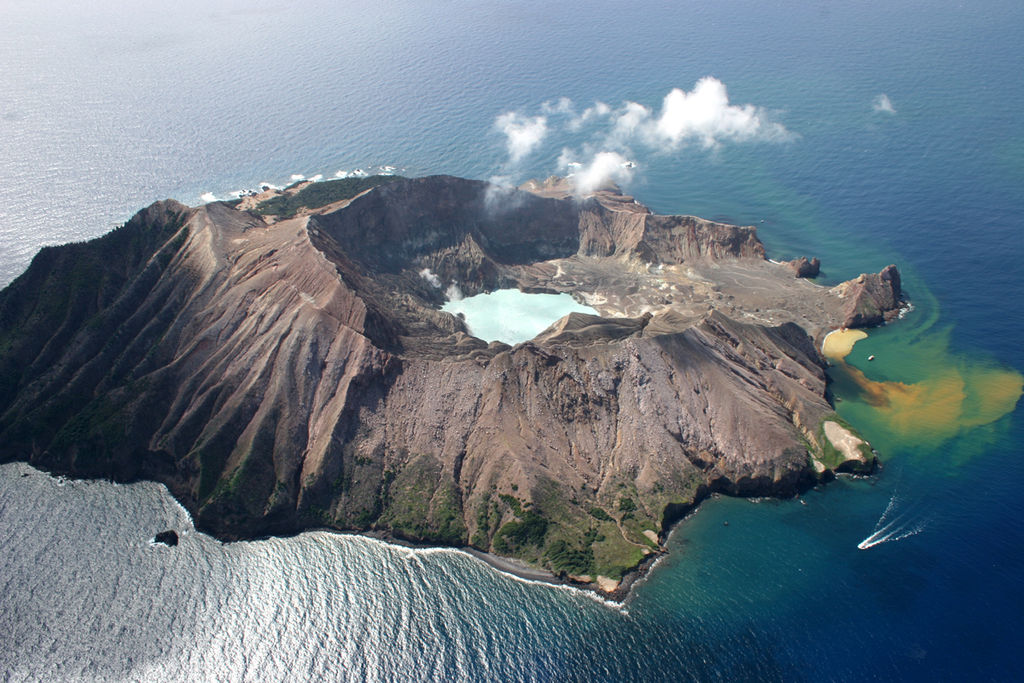
“I’m imagining everyone’s interested in the Whakaari case study, which is a really interesting one, from the perspective that it’s a privately owned, offshore island. It doesn’t fall within the conservation estate, therefore it’s not managed by DOC, and so it actually falls under some different settings there.”